Translations:Neues Bauen am Horn/1/en: Unterschied zwischen den Versionen
Zur Navigation springen
Zur Suche springen
| Zeile 4: | Zeile 4: | ||
| Map = {{#multimaps: 50.9785, 11.3417}} | | Map = {{#multimaps: 50.9785, 11.3417}} | ||
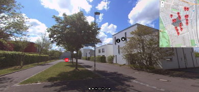
| Location / Geocoordinates Starting point = Latitude: 50° 58' 42.6" N <br> Longitude: 11° 20' 30.12" E | | Location / Geocoordinates Starting point = Latitude: 50° 58' 42.6" N <br> Longitude: 11° 20' 30.12" E | ||
| − | | | + | | Learning objectives = Rough draft of a drainage concept for an existing area with approx. 60 residential buildings |
| − | | | + | | Site = Weimar, Germany |
| − | | | + | | Category = |
| − | | | + | | Languages available = German, English |
| − | | | + | | Year of application creation = 20xx |
| − | | | + | | Creator = [https://www.uni-weimar.de/index.php?id=49631 Florian Wehking] |
| − | + | | Recording type = | |
| − | | | + | | Stereoscopic (3D) recording = |
| + | | VR usage = | ||
| + | | Application link = [https://360-degree.education/NeuesBauenAmHorn/ www.360-degree.education/NeuesBauenAmHorn/] | ||
Version vom 16. Mai 2022, 11:08 Uhr
{{Infobox 360 degree models | Name = Residential area: Neues Bauen am Horn
| Figure =

| Map =
Lade Karte …
| Location / Geocoordinates Starting point = Latitude: 50° 58' 42.6" N
Longitude: 11° 20' 30.12" E
| Learning objectives = Rough draft of a drainage concept for an existing area with approx. 60 residential buildings
| Site = Weimar, Germany
| Category =
| Languages available = German, English
| Year of application creation = 20xx
| Creator = Florian Wehking
| Recording type =
| Stereoscopic (3D) recording =
| VR usage =
| Application link = www.360-degree.education/NeuesBauenAmHorn/